

Project partners: Prehnit d.o.o. (FR1), NMT Geoplan d.o.o. (FR2) and Infrastruktura d.o.o. (FR3).
The GeoNext project aims to enhance the competitiveness of three small and micro
companies in the spatial planning industry by combining their expertise. The project will
develop a novel GIS-based automated spatial planning solution using cutting-edge geoportal
software. This solution will improve data acquisition, processing, and visualization through
advanced techniques like aero photogrammetry, LiDAR scanning, and big data analytics.
The integrated GIS solution includes:
- Advanced data acquisition using drones with LiDAR and high-resolution cameras;
- Established data processing procedures;
- A digital interactive map tailored for spatial planning, with a multi-language interface
for international reach.
The solution consists of three modules developed by each partner:
- Field data collection module by FR1;
- Cadastral survey support module by FR2;
- Infrastructure mapping module by FR3.
The project will also strengthen technical capacities by procuring specialized equipment
and transferring knowledge among partners. The primary beneficiaries will be public
entities like cities and municipalities, who will receive more accurate and efficient spatial
planning services initially in three counties and later in the SEE region.
-Total Small Project budget in EUR: 213.395,40 EUR
-The amount of EU co-financing in EUR: 181.386,09 EUR (85% co-funding rate)
-Duration of the Small Project: 04/02/2025- 04/02/2026
-The location of the Small Project and the countries concerned: Oštarije- Hrvatska (Croatia), Derventa- BiH (Bosnia and
Herzegovina), Podgorica- Crna Gora (Montenegro)
-Small Project Fund: “EmBRACE” (Enhancing MSEs
sustainaBle gRowth And CompEtitiveness) Interreg VI-A IPA Croatia – Bosnia and
Herzegovina – Montenegro 2021-2027 Programme)
Contact: Miloš Tutnjević, nmtgeoplanbl@gmail.com, +387 66 350 870
More information here.
This website has been produced with the assistance of the European Union. The contents of this website are the sole responsibility of NMT Geoplan d.o.o. (FR2) and can in no way be taken to reflect the views of the European Union.
Our company successfully completed the design, establishment, and measurement of the primary geodetic network for the construction of the A11 highway on the Vukosavlje–Brčko section. The project was implemented for the investor "Autoputevi Republike Srpske", with CSCEC Limited as the main contractor. High-precision engineering geodesy work was carried out using modern equipment and expert staff, achieving excellent results in accordance with the highest industry standards.

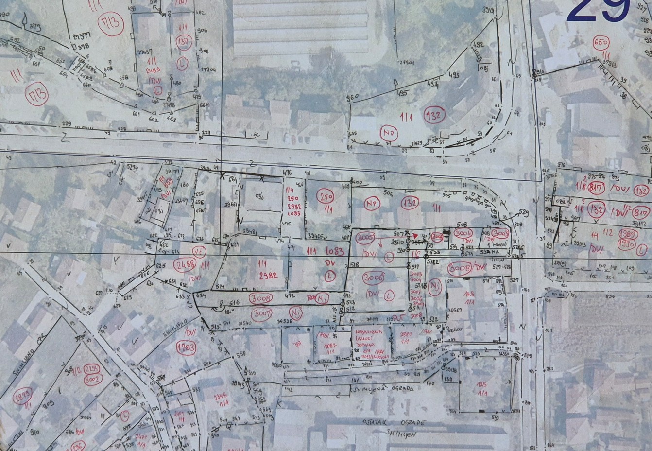
A geodetic survey has been successfully completed in the cadastral municipality Zvornik 1, funded by the Republic Administration for Geodetic and Property-Legal Affairs of RS. The works took place from August 2024 to June 2025. A 1:1000 scale plan was created using classical geodetic methods. This project provides the basis for establishing a Unified Real Estate Cadastre in the area.
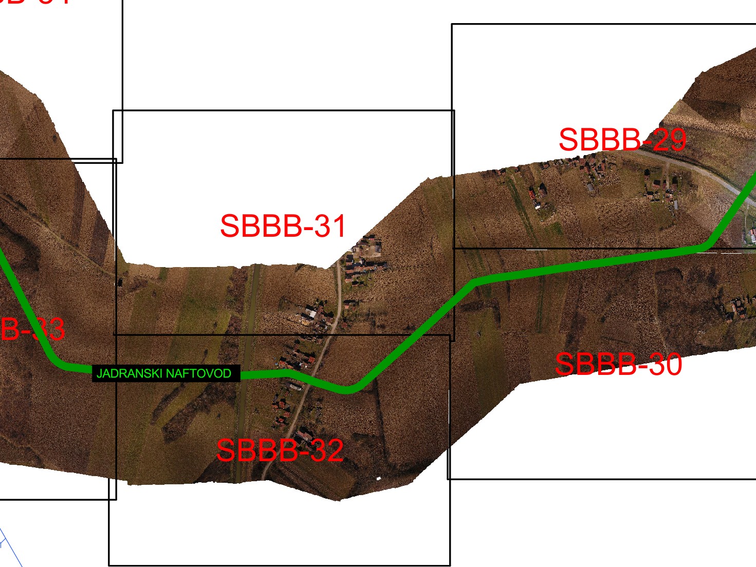
In March 2024, our company conducted a project involving aerial photogrammetric imaging and data collection on land rights and parcels along the route of the JANAF pipeline in Bosnia and Herzegovina, leading to the Brod Refinery. The project, commissioned and funded by JANAF, supports the conservation and cleaning of this pipeline section. High-resolution imagery was acquired using drone-based photogrammetry.
 +387 65 524 247
 nmtgeoplan@gmail.com